


Jeganathan Chockalingam Chockalingam PostDoc (University of Southampton, United Kingdom) Ph.D. (Forest Geoinformatics) (FRI, Dehradun) M.Sc. (Geoinfomatics) (ITC, Enschede, Netherlands) M.Sc. (Physics) (MKU, Madurai, India)
Date of Joining:
1st September, 2011
-
Department of Remote Sensing BIT, Mesra, Ranchi - 835215
-
2275444-extn. 4768|NIL
-
jeganathanc@bitmesra.ac.in

Research Areas
- Remote Sensing based vegetation and environmental Analysis
- Modelling Space-Time vegetation dynamics and climate change impact
- Land Surface Phenology and Climate Change
- Climate Change Vulnerability Assessment
- Landscape Metrics and Modelling
- Land Cover Change Modelling
- Geostatistical Modelling
- Downscaling of Satellite data
- Spatial Multi-criteria decision modelling
- RSGIS Software Development.

Work Experience
- Teaching: 28 Years
- Research: 31 Years
- Industry: 31 Years




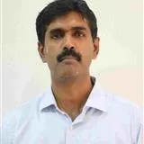 Jeganathan Chockalingam
"
width="406"
height="371"
loading="lazy"
>
Academic Profile

Award and Honours

Project
Leadership & Institutional Service
Teaching & Mentorship
Award and Honours
Letter of Appreciation from Director-General, Forest Survey of India (2023)
INSA Teachers Award (2020) – Indian National Science Academy Award
Samaj Bandhu Award – Education (2019) from Prantik - Care the Earth
Current Sponsored Projects
- STAMP- Customised Software Package – Spatio-Temporal Analysis and Modelling of Phenology of natural vegetation using ArcGIS, Arcobjects and Visual Basic (Software Product and Manuals). ICIMOD-NASA-SERVIR Project over Hindu Kush Himalaya using Satellite Re
- DST-PURSE project on “Center for Advanced Research on Machine Learning for Geospatial Analytics and Solutions for the State of Jharkhand (ARMLEGS)” (Rs. 8.5 Crore). (13, Jan, 2023).
- Quantifying the Spatio-Temporal rhythm of vegetation growth, health and its vulnerability due to climate change in different forest ecosystem in North-Eastern India using time-series satellite data. ISRO-RESPOND project. (Rs. 29,45,000).
- National Level Project: Use of Geoinformatics in Rural Road Projects under Pradan Mantri Gram Sadak Yojna (PMGSY) (Bihar State) (Project Amount is: Rs. 54,33,704). User Agency: National Remote Sensing Centre (NRSC), ISRO, Hyderabad.