


Akhouri Pramod Krishna
M.Tech, Ph.D
Date of Joining:
18th February, 2005
-
Department of Remote Sensing and Geoinformatics, Birla Institute of Technology (BIT), Mesra, Ranchi 835215, Jharkhand, India
-
+91-(0)651-2275444/2275896 Ext. 4275|+91-(0)651-3157182
-
apkrishna@bitmesra.ac.in

Research Areas
- Climate Change, Snow Cover, Glacier Dynamics: 2 PhDs with multiple publications/ conference presentations, 1 more PhD scholar being guided in this area. 4 MTech (Remote Sensing) dissertation and 3 MSc (Geoinformatics) thesis supervised with 2 of these MTech dissertation under joint supervision arrangement from Remote Sensing Group Bern, University of Bern, Switzerland and University of Zurich, Switzerland (later Delhi University).
- Natural Hazards, Disaster Management: 3 PhDs with multiple publications/ conference presentations. 3 MTech (Remote Sensing) dissertation and 5 MSc (Geoinformatics) thesis supervised.
- Natural Resources and Basin Hydrology: 4 PhDs with multiple publications/ conference presentations. 3 more PhD scholars being guided. 9 MTech (Remote Sensing) dissertation and 5 MSc (Geoinformatics) thesis supervised.
- Planetary Remote Sensing, Satellite Geodesy & Geo-sciences: 3 PhDs and multiple publications/conference presentations. 1 MTech (Remote Sensing) dissertation and 3 MSc (Geoinformatics) thesis supervised.
- Urban and Built Environment: 2 PhDs with multiple publications/conference presentations. 5 MTech (Remote Sensing) dissertation and 5 MSc (Geoinformatics) thesis supervised.
- Spatio-temporal discharge trend assessment and forecasting of the upper Subarnarekha river using geospatial and machine learning techniques – Mr Prashant Parasar, PHD/RS/10003/2020 (Department of Remote Sensing & Geoinformatics, BIT Mesra, India – Guide) – 2026
- Thermophysical property and crater morphometry of Martian Gale crater and surroundings – Ms Farzana Shaheen, PHD/RS/10001/2016 (Department of Remote Sensing, BIT Mesra, India – Co-Guide) – 2024
- Aeolian activities over Gale crater and its surroundings driven by Martian climatic parameters – Ms Nayama Valsa Scariah, PHD/RS/10003/2017 (Department of Remote Sensing, BIT Mesra, India – Co-Guide) - 2024
- Generation of reflectance-based models for Iron and Titanium abundance and boulder fall mapping around Aristarchus Plateau using Lunar datasets - Mr. Subhadyouti Bose, PHD/RS/10005/2017 (Department of Remote Sensing, BIT Mesra, India – Guide) - 2023
- Spatio-temporal assessment of glaciers and lakes in high mountains of Sikkim Himalaya for inferring changes and impacts – Ms Pranata Hazra, PHD/RS/10001/2014 (Department of Remote Sensing, BIT Mesra, India – Guide) – 2021
- Forest biomass mapping using multi-frequency and multi-polarization SAR data coupled with optical data – Mr. Praveen Kumar, PHD/RS/10054/2013 (Department of Remote Sensing, BIT Mesra, India – Guide) – 2020
- Long term evaluation of land surface evapo-transpiration (ET) over eastern part of India - Ms Shweta PHD/AM/1054/2011 (Centre of Excellence in Climatology, Deptt. Of Physics, BIT Mesra, India – Guide; joint guidance with Dr. Bimal K. Bhattacharya, Head, AED, SAC, ISRO) - 2020
- Spatial-temporal analysis and modelling of urban system using geo-statistical and geo-spatial techniques – Mr. Alok Bhushan Mukherjee, PHD/RS/10001/2012 (Department of Remote Sensing, BIT Mesra, India – Guide) - 2019
- Influence of geological and geoengineering parameters in assessing the instability of slopes of open pit coal and lignite mines - Mr. Somesh Sengupta PHD/103/2010 (Department of Civil & Environmental Engg., BIT Mesra, India– Co-Guide) – 2018
- Geo-environmental assessment of coalfield region using geoinformatics techniques in Ramgarh and part of Hazaribagh district, Jharkhand, India – Mr. Akshay Kumar, PHD/RS/10004/2012 (Department of Remote Sensing, BIT Mesra, India – Guide) – 2018
- Snow cover dynamics and climate change impact on hydrological regime of Chenab basin, Western Himalayas –Ms Retinder Kour, PHD/RS/1051/2011 (Department of Remote Sensing, BIT Mesra, India – Co-Guide) – 2018
- Development of geographical information system (GIS) based management information system (MIS) for solid waste management in Indian cities – Mr. Koushik Paul, Index No. 192/11/E (Department of Civil Engg., Jadavpur University, India – Co-Guide with Dr. Amit Dutta, Professor, Jadavpur University) – 2018
- Geospatial assessment of watershed management interventions for sustainable resource conservation in upper Subarnareka river sub-basin, Jharkhand (India) – Mr. Shuvabrata Chatterjee, PHD/RS/1051/2010 (Department of Remote Sensing, BIT Mesra, India) – Guide – 2016
- Landslide hazard characterization using remote sensing and geographical information system (GIS) – a study in parts of West Sikkim Himalaya – Mr. Sanjib Kundu (Department of Geological Sciences, Jadavpur University, India – Guide; joint guidance with Dr. Sisir Kanti Nag, Professor, Jadavpur University – 2003
- Ms Farhin Tabassum (PHD/RS/10008/2020 – Department of Remote Sensing, BIT Mesra) – CSIR- SRF
- Mr. Abhishek Ojha (PHD/RS/10052/2020 – Department of Remote Sensing, BIT Mesra) – SF Research Scholar
- Ms Sharayu Dhondu Botle (PHD/RS/10051/2022 – Department of Remote Sensing, BIT Mesra) – SF PT Research Scholar
- Mr. Vishal Kumar (PHD/RS/10011/2020 – Department of Remote Sensing, BIT Mesra) – SF PT Research Scholar
- Glacial Lake Outburst Flood (GLOF) Hazard and Risk Assessment of Maban Lake in the Lassar Yankti Basin of Uttarakhand Using Geospatial Technology and Hydrodynamic Modelling by Sudip Banerjee (MT/RS/10004/23) supervised jointly with Dr. Amit Kumar, Wadia Institute of Himalayan Geology (WIHG)
- Urban Flooding as a Consequence of Urbanization- A Geospatial Assessment of Chennai by Arghya Haldar (MT/RS/10005/23)
- Lunar Surface Temperature Estimation Using LRO Diviner Data for Shiv Shakti Point and Surrounding Region by Lopamudra Ghosh (MT/RS/10007/23) being supervised jointly with Dr. Mili Ghosh (DRS)
- Assessment of hydrological potential of a micro-catchment area (BIT Mesra campus) using geospatial technologies by Ramdoot Shaw (MT/RS/10003/22) supervised jointly with Dr. V.S. Rathore (DRS)
- Identification of surge type glaciers using Remote Sensing and Machine Learning by Pratik Shashwat (MT/RS/10008/21) supervised jointly with Dr. V.S. Rathore (DRS)
- Remote Sensing Based Assessment of Trends of Hydrological Parameters of Upper Subarnarekha River Basin by Irshad Ali (MT/RS/10007/20) supervised jointly with Dr. C. Jeganathan (DRS)
- Spatio-temporal change assessment of urban transformation of Chandigarh using geo-spatial techniques by Bhavna Sharma (MT/RS/10002/19)
- Feasibility and geo-environmental assessment of Yanuma-Luni –Sukri river interlinking using RS and GIS techniques by Kshitij Divyansh (MT/RS/10010/19) supervised jointly with Dr. V.S. Rathore (DRS)
- Accuracy study of snow cover maps based on AVHRR data with different spatial resolution by Soumita Patra (MT/RS/10005/18) supervised jointly with Dr. Stefan Wunderle, Institute of Geography, Remote Sensing Group Bern, University of Bern, Switzerland
- Recent trend in planimetric and mass changes of Baling glacier in Central Himalaya by Ajay Godara (MT/RS/10002/18) supervised jointly with Dr. Suraj Mal, Delhi University/earlier with University of Zurich, Switzerland
- Assessment of surge glacier dynamics on Fisher and Klutlan glaciers, St. Elias Mountains, North America by Arjun Pratap Shahi (MT/RS/10009/2017) supervised jointly with Dr. R. Bhambri, Centre for Glaciology (CFG), Wadia Institute of Himalayan Geology
- Characterization of Damodar - Barakar river basin for water resource assessment and identification of critical locations for water conservation by Soumita Sengupta (MT/RS/10007/2017) supervised jointly with Dr. V.S. Rathore (DRS) and Dr. Y.K. Srivastava, RRSSC-East, NRSC
- Identifying environmental pollution of opencast coal mining areas using imaging spectrometer data by Sallwi Gautam (MT/RS/10010/17) supervised jointly with Dr. Richa Sharma (DRS)
- Generation of Digital Elevation Model and information extraction from UAV acquired images over BIT Campus by Sourav Suman (MT/RS/10001/2016) supervised jointly with Dr. C. Jeganathan (DRS)
- An assessment of a part of Subarnarekha river sub-basin to infer trend of Spatio-temporal changes by Suparna Dey (MT/RS/10003/16) supervised jointly with Dr. Richa Sharma (DRS)
- Impact of aerosol on the variability of Indo-gangetic plain climate by Ashish Mishra (MT/RS/10007/2015)
- Assessment of phyllosilicates over the mawrthvallis region of Mars using CRISM data by Md. Shahid Iqbal Ansari (MT/RS/10008/2015) supervised jointly with Dr. Mili Ghosh (DRS)
- Assessment of Remote Sensing(RS) methods and computational techniques for possible earthquake prediction by Nilendu Das (MTRS/10009/2014)
- Smart cities: a comparative study between Gaya and Ranchi by Prabha Kumari (MTRS/10006/2014) supervised jointly with Dr. Rich Sharma (DRS)
- Identification of Desakota region and urban growth potential areas in Patna city, India using satellite remote sensing data by Badiuzzaman Khan (MTRS/10007/2014) supervised jointly with Dr. V.S. Rathore (DRS)
- Application of hyperspectral remote sensing discrimination in Saranda forest and its surrounding regions by Hemant Kumar (MTRS/10011/2014) supervised jointly with Dr. Rich Sharma (DRS)
- Assessment of forest cover conditions and canopy density using remote sensing and GIS techniques in parts of Jharkhand State by Jai Kumar (MTRS/10003/2013)
- Analysis of land use spatial patterns in costal Andhra region using remote sensing, GIS and computational techniques by Mohammed Ateeque Ahammed Khan (MTRS/10006/2013)
- Spatio-temporal variation of lightning induced NOx over Jharkhand by Vidhyasagar (MTRS/10009/2013) supervised jointly with Dr. Mili Ghosh (DRS)
- Detecting trend and seasonal changes in satellite image time series using BFAST (Breaks for Additive Season and Trend) by Vishwajeet Kumar (MTRS/10008/2013) supervised jointly with Dr. Richa Sharma (DRS)
- Assessment of impact of land use/ land cover change on runoff of Hyderabad city using geoinformatics techniques by Roopali Rawat (MTRS/10004/2012)
- Application of geoinformatics for landslide susceptibility assessment in a part of Sikkim state by Sandip Banerjee (MTRS/10007/2012)
- Accuracy assessment of urban land use/land cover classification using different digital image processing techniques by Rahul Sarkar (MTRS/10008/2012)
- Study of morphological changes of the river Ganga in Patna district, Bihar using remote sensing and GIS techniques by Bhawesh Kumar (MTRS/1011/2011) supervised jointly with Dr. Richa Sharma (DRS)
- Landslide susceptibility analysis using Remote Sensing and GIS techniques in a part of Chamoli district, Uttarakhand, India by Santosh Kumar (MTRS/1012/2011)
- Watershed characterisation for assessing erosional behaviour through geoinformatics by Prasanta Kumar Bez (Batch of 2010)
- An assessment of potential ground water recharge site using geoinformatics in Kanke block, Ranchi district by Nemika Kumari (Batch of 2010)
- Spatio-temporal Assessment of Urban Green Space of Ranchi City and Its Climatic Implications by Rohit Lakra (MGI/10001/23)
- Sikkim Glacial Lake Outburst Flood (GLOF) Disaster of 2023: Geoinformatics Based Assessment of Causes & Impact by Radha Raman Das (MGI/10005/23)
- Spatio - Temporal Assessment of Wayanad Region for Inferring its Geo-Environmental Setup and Landslide Proneness by Sandra S. Kumar (MGI/10012/23)
- Geospatial and Machine Learning Technique based Zonation of Groundwater Potential: A Case Study of Ranchi District, Jharkhand, India by Rani Kumari (MGI/10010/22)
- Study of Himalayan Glaciers using Remote Sensing and Climate model projections by Protyusha Mukhopadhyay (MGI/10001/22) supervised jointly with Dr. Swagata Payra (DRS) and Dr. T.P. Sabin (IITM-Pune)
- Assessment of spatiotemporal variations in Urban Heat Island effect within the Kolkata Metropolitan Area by Nabeeha Jamil (MGI/10001/21)
- Climate change effect and glaciers health assessment using Remote Sensing data by Aditi Sharma (MGI/10009/21) supervised jointly with Dr. V.S. Rathore (DRS)
- Detection of Forest Fire in the Central Himalaya and Assessment of Environmental Impact Using Geoinformatics by Saurav Deka (MGI/10011/20) supervised jointly with Dr. Swagata Payra (DRS)
- Computation of Topographic Wetness Index - A Comparison of Different Digital Elevation Models by Mariya Sunil (MGI/10007/20) supervised jointly with Dr. C. Jeganathan (DRS)
- Characterization of Lunar Surface South Pole Region Impact Crater and Their Morphometric Analysis Using Chandrayaan-2 DFSAR Data by Nitish Kumar (MGI/10010/20) supervised jointly with Dr. V.S. Rathore (DRS)
- Characterizing the Processes Involved in Boulder Fall Activity in Vallis Schroterl, Moon by Annu Kumari (MGI/10001/20) supervised jointly with Dr. Mili Ghosh nee Lala (DRS)
- Automatic crater detection on Lunar surface by Avinash Das (MGI/10007/19) supervised jointly with Dr. Mili Ghosh nee Lala (DRS) and Dr. Shruti Garg (CSE), BIT Mesra
- Assessment of Landscape Dynamics using Geospatial Technology: A Case Study of Dhanbad District, Jharkhand by Nitish Kumar (MGI/10009/19) supervised jointly with Dr. Alok B. Mukherjee, Chief Remote Sensing-GIS Analyst, R & D Head - NE India Operations, LeadsConnect Services Pvt Ltd
- Satellite remote sensing based assessment of total and tropospheric ozone influencing the climate by Atma Deep Dutta (MGI/10005/2017) supervised jointly with Dr. Mili Ghosh (DRS)
- Landfill site selection for solid waste using site sensitivity index in Ranchi by Ranjan (MGI/10011/17)
- Application of UAV based photogrammetry for BIT Campus survey and mapping by Sandhya Rani (MGI/10003/2016)
- Evaluation of satellite derived DEM with high spatial resolution DEM derived from RTK DGPS by Prashant Parasar (MGI/10006/2015) supervised jointly with Dr. C. Jeganathan (DRS)
- Seismic risk mapping of parts of Sikkim using geoinformatics by Rachna Sunanda Kachhap (MGI/10009/2015)
- Application of geoinformatics techniques for flood hazard assessment in parts of North 24 Paragana district (West Bengal) by Sayani Biswas (MGI/10002/2014)
- Assessment of mine fire prone areas through thermal Remote Sensing technique by Farzana Shaheen (MGI/10008/2014) supervised jointly with Dr. V.S. Rathore (DRS)
- Study of urban heat island effect in Kolkata and surrounding areas through satellite data by Angana Roy (MGI/10001/2014) supervised jointly with Dr. Richa Sharma (DRS)
- Municipal solid waste disposal site selection using AHP and GIS overlay techniques by Pooja Kumari (MGI/10008/2012)
- Estimation of ice velocity using differential SAR interferometry of Milam glacier by Rohit Kumar (MGI/10010/2012)
- Snow cover and land surface temperature assessment of Gangotri basin in the Indian Himalayan Region (IHR) using MODIS satellite data by Anurag Sharma (MGI/1005/2011)
- Mine fire and land use/land cover change assessment of Jharia coalfield area using geoinformatics by Nidhi Rani (MGI/1006/2011)
- Geospatial analytical assessment of ground water characteristics of mining areas of Musabani block East Singhbhum, Jharkhand by Dibyendu Bikas Nayak (MGI/1012/2010) supervised jointly with Dr. N. Patel (DRS)
- Environmental impact prediction through remote sensing based assessment of above ground biomass for different mining zones in Musabani block, East Singhbhum, Jharkhand by Jaydeep Singh Rathaur (MGI/1013/2010)
- Application of Remote Sensing and GIS techniques in transportation network analysis of Jamshedpur city, Jharkhand by Abhilasha (MGI/1010/06)
- Spatio-Temporal Analysis of MODIS-Derived LST and Rainfall in Jharkhand: A Case Study , ANKIT KUMAR SRIVASTAV, PG/SOBAS/07/24/093, M.Sc (Geoinformatics), , Adamas University, Kolkata (June – July, 2025) supported by DST-PURSE Project (Department of Computer Science & Engg.; Department of Remote Sensing and Geoinformatics)
- Spatio-Temporal Analysis of Satellite-Derived Atmospheric Pollutants over Jharkhand , CHIRASHRI BHATTACHARYA, MT/CS/10007/23, M.Tech (CS), BIT Mesra (June – July, 2025) supported by DST-PURSE Project (Department of Computer Science & Engg.; Department of Remote Sensing and Geoinformatics)
- Cryospheric remote sensing for assessing glacier mass balance , RAJNANDINI SAHA, M.Sc (Geoinformatics), Amity Institute of Geoinformatics and Remote Sensing (AIGIRS), Amity University, NOIDA (May 14 – July 5, 2024)
- Watershed Hydrology Modelling using Geospatial Tools , ANNADASANKAR BERA, M.Sc (RS & GIS), Vidyasagar University, W.B. (July 1 - Aug 9, 2021)
- Watershed Hydrology Modelling using Geospatial Tools , SANJUKTA DAS, M.Sc (RS & GIS), Vidyasagar University, W.B. (July 1 - Aug 9, 2021)
- Geospatial techniques for study of snow and glacier characteristics , ABIR KANJILAL, BS MS Dual degree (17MS142), Indian Institute of Science Education and Research (IISER), Kolkata (May 24 - July 7, 2019)
Geospatial Technology/Remote Sensing/Geoinformatics application areas:
PhD Research Supervision:
Awarded-
Submitted –
Ms Nikita Roy Mukherjee (PHD/RS/10005/2020 – Department of Remote Sensing & Geoinformatics, BIT Mesra)– 2026
Ongoing-
Post Graduate Dissertations/Projects:
M.Tech (Remote Sensing)
M.Sc (Geoinformatics)
Internship mentoring:

Work Experience
- Teaching: 22 Years
- Research: 39 Years
- Industry: 39 Years




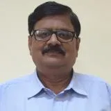 Akhouri
"
width="406"
height="371"
loading="lazy"
>
Academic Profile

Award and Honours

Project
Leadership & Institutional Service
Teaching & Mentorship
Award and Honours
Invited to the Dryland Congress 2026 to participate as panellist in the side event titled Climate Smart & Value Chain Analytics for Resilient & Sustainable Agriculture being organised by ‘ICRISAT’ in collaboration with ‘LeadsConnect Services Pvt. Ltd.’ at
Invited and participated in 30th Meeting of Jharkhand State Geological Programming Board (JSGPB)-cum-Technical Deliberation on Application of AI and ML in Geology & Mining, 9 September 2026, Radisson Blu Hotel, Ranchi.
Invited as a Resource Person and delivered a talk in a program on ‘National Space Day’ at the Geology Department, St. Xavier’s College (Autonomous College of Ranchi University), 22 August 2026, Fr. Proost Hall (SXC), Ranchi.
Current Sponsored Projects
- Remote Sensing based Hydrologic budget of the Subarnarekha River Basin, DST-Science and Engineering Research Board (SERB), New Delhi, Rs. 27.39 L (2020 – 23) - A P Krishna, C Jegannathan, V S Rathore
- SMG-BIT Agriculture Research Project, SKY MAP Global Pvt. Ltd., Rs. 7.50 L (2019-20) - C Jeganathan, A P Krishna, V Bhattacharjee, A Mustafi, S Mishra
- National Land Degradation Mapping - 2nd Cycle, NRSC/DoS Hyderabad, Rs. 16.50 L (2016 - 18) - A P Krishna, C Jeganathan, V S Rathore, N K Sinha
- Digital Photogrammetry Laboratory at Remote Sensing Department, BIT Mesra, DST FIST Level I grant, GoI; 2006, 38 L (2006-11) - M S Nathawat, A P Krishna
Intellectual Property Rights (IPR)
-
Indian Patent Application no. 202631100313 filed on 19 August 2026 Inventors: Banerjee, S., Mahto, S., Krishna, A.P., Roy Mukherjee, N., Anand, S., Rathore, V.S., Kumar, A. Title: ‘A method and system for water body morphometry’
- Date:
Fellowship
- Fellow Member, Geological Society of India [FGSInd] – 2004-2011