


Akhouri Pramod Krishna
M.Tech, Ph.D
Date of Joining:
18th February, 2005
-
Department of Remote Sensing and Geoinformatics, Birla Institute of Technology (BIT), Mesra, Ranchi 835215, Jharkhand, India
-
+91-(0)651-2275444/2275896 Ext. 4275|+91-(0)651-3157182
-
apkrishna@bitmesra.ac.in

Research Areas
- Climate Change, Snow Cover, Glacier Dynamics: 2 PhDs with multiple publications/ conference presentations, 1 more PhD scholar being guided in this area. 4 MTech (Remote Sensing) dissertation and 3 MSc (Geoinformatics) thesis supervised with 2 of these MTech dissertation under joint supervision arrangement from Remote Sensing Group Bern, University of Bern, Switzerland and University of Zurich, Switzerland (later Delhi University).
- Natural Hazards, Disaster Management: 3 PhDs with multiple publications/ conference presentations. 3 MTech (Remote Sensing) dissertation and 5 MSc (Geoinformatics) thesis supervised.
- Natural Resources and Basin Hydrology: 4 PhDs with multiple publications/ conference presentations. 3 more PhD scholars being guided. 9 MTech (Remote Sensing) dissertation and 5 MSc (Geoinformatics) thesis supervised.
- Planetary Remote Sensing, Satellite Geodesy & Geo-sciences: 3 PhDs and multiple publications/conference presentations. 1 MTech (Remote Sensing) dissertation and 3 MSc (Geoinformatics) thesis supervised.
- Urban and Built Environment: 2 PhDs with multiple publications/conference presentations. 5 MTech (Remote Sensing) dissertation and 5 MSc (Geoinformatics) thesis supervised.
- Spatio-temporal discharge trend assessment and forecasting of the upper Subarnarekha river using geospatial and machine learning techniques – Mr Prashant Parasar, PHD/RS/10003/2020 (Department of Remote Sensing & Geoinformatics, BIT Mesra, India – Guide) – 2026
- Thermophysical property and crater morphometry of Martian Gale crater and surroundings – Ms Farzana Shaheen, PHD/RS/10001/2016 (Department of Remote Sensing, BIT Mesra, India – Co-Guide) – 2024
- Aeolian activities over Gale crater and its surroundings driven by Martian climatic parameters – Ms Nayama Valsa Scariah, PHD/RS/10003/2017 (Department of Remote Sensing, BIT Mesra, India – Co-Guide) - 2024
- Generation of reflectance-based models for Iron and Titanium abundance and boulder fall mapping around Aristarchus Plateau using Lunar datasets - Mr. Subhadyouti Bose, PHD/RS/10005/2017 (Department of Remote Sensing, BIT Mesra, India – Guide) - 2023
- Spatio-temporal assessment of glaciers and lakes in high mountains of Sikkim Himalaya for inferring changes and impacts – Ms Pranata Hazra, PHD/RS/10001/2014 (Department of Remote Sensing, BIT Mesra, India – Guide) – 2021
- Forest biomass mapping using multi-frequency and multi-polarization SAR data coupled with optical data – Mr. Praveen Kumar, PHD/RS/10054/2013 (Department of Remote Sensing, BIT Mesra, India – Guide) – 2020
- Long term evaluation of land surface evapo-transpiration (ET) over eastern part of India - Ms Shweta PHD/AM/1054/2011 (Centre of Excellence in Climatology, Deptt. Of Physics, BIT Mesra, India – Guide; joint guidance with Dr. Bimal K. Bhattacharya, Head, AED, SAC, ISRO) - 2020
- Spatial-temporal analysis and modelling of urban system using geo-statistical and geo-spatial techniques – Mr. Alok Bhushan Mukherjee, PHD/RS/10001/2012 (Department of Remote Sensing, BIT Mesra, India – Guide) - 2019
- Influence of geological and geoengineering parameters in assessing the instability of slopes of open pit coal and lignite mines - Mr. Somesh Sengupta PHD/103/2010 (Department of Civil & Environmental Engg., BIT Mesra, India– Co-Guide) – 2018
- Geo-environmental assessment of coalfield region using geoinformatics techniques in Ramgarh and part of Hazaribagh district, Jharkhand, India – Mr. Akshay Kumar, PHD/RS/10004/2012 (Department of Remote Sensing, BIT Mesra, India – Guide) – 2018
- Snow cover dynamics and climate change impact on hydrological regime of Chenab basin, Western Himalayas –Ms Retinder Kour, PHD/RS/1051/2011 (Department of Remote Sensing, BIT Mesra, India – Co-Guide) – 2018
- Development of geographical information system (GIS) based management information system (MIS) for solid waste management in Indian cities – Mr. Koushik Paul, Index No. 192/11/E (Department of Civil Engg., Jadavpur University, India – Co-Guide with Dr. Amit Dutta, Professor, Jadavpur University) – 2018
- Geospatial assessment of watershed management interventions for sustainable resource conservation in upper Subarnareka river sub-basin, Jharkhand (India) – Mr. Shuvabrata Chatterjee, PHD/RS/1051/2010 (Department of Remote Sensing, BIT Mesra, India) – Guide – 2016
- Landslide hazard characterization using remote sensing and geographical information system (GIS) – a study in parts of West Sikkim Himalaya – Mr. Sanjib Kundu (Department of Geological Sciences, Jadavpur University, India – Guide; joint guidance with Dr. Sisir Kanti Nag, Professor, Jadavpur University – 2003
- Ms Farhin Tabassum (PHD/RS/10008/2020 – Department of Remote Sensing, BIT Mesra) – CSIR- SRF
- Mr. Abhishek Ojha (PHD/RS/10052/2020 – Department of Remote Sensing, BIT Mesra) – SF Research Scholar
- Ms Sharayu Dhondu Botle (PHD/RS/10051/2022 – Department of Remote Sensing, BIT Mesra) – SF PT Research Scholar
- Mr. Vishal Kumar (PHD/RS/10011/2020 – Department of Remote Sensing, BIT Mesra) – SF PT Research Scholar
- Glacial Lake Outburst Flood (GLOF) Hazard and Risk Assessment of Maban Lake in the Lassar Yankti Basin of Uttarakhand Using Geospatial Technology and Hydrodynamic Modelling by Sudip Banerjee (MT/RS/10004/23) supervised jointly with Dr. Amit Kumar, Wadia Institute of Himalayan Geology (WIHG)
- Urban Flooding as a Consequence of Urbanization- A Geospatial Assessment of Chennai by Arghya Haldar (MT/RS/10005/23)
- Lunar Surface Temperature Estimation Using LRO Diviner Data for Shiv Shakti Point and Surrounding Region by Lopamudra Ghosh (MT/RS/10007/23) being supervised jointly with Dr. Mili Ghosh (DRS)
- Assessment of hydrological potential of a micro-catchment area (BIT Mesra campus) using geospatial technologies by Ramdoot Shaw (MT/RS/10003/22) supervised jointly with Dr. V.S. Rathore (DRS)
- Identification of surge type glaciers using Remote Sensing and Machine Learning by Pratik Shashwat (MT/RS/10008/21) supervised jointly with Dr. V.S. Rathore (DRS)
- Remote Sensing Based Assessment of Trends of Hydrological Parameters of Upper Subarnarekha River Basin by Irshad Ali (MT/RS/10007/20) supervised jointly with Dr. C. Jeganathan (DRS)
- Spatio-temporal change assessment of urban transformation of Chandigarh using geo-spatial techniques by Bhavna Sharma (MT/RS/10002/19)
- Feasibility and geo-environmental assessment of Yanuma-Luni –Sukri river interlinking using RS and GIS techniques by Kshitij Divyansh (MT/RS/10010/19) supervised jointly with Dr. V.S. Rathore (DRS)
- Accuracy study of snow cover maps based on AVHRR data with different spatial resolution by Soumita Patra (MT/RS/10005/18) supervised jointly with Dr. Stefan Wunderle, Institute of Geography, Remote Sensing Group Bern, University of Bern, Switzerland
- Recent trend in planimetric and mass changes of Baling glacier in Central Himalaya by Ajay Godara (MT/RS/10002/18) supervised jointly with Dr. Suraj Mal, Delhi University/earlier with University of Zurich, Switzerland
- Assessment of surge glacier dynamics on Fisher and Klutlan glaciers, St. Elias Mountains, North America by Arjun Pratap Shahi (MT/RS/10009/2017) supervised jointly with Dr. R. Bhambri, Centre for Glaciology (CFG), Wadia Institute of Himalayan Geology
- Characterization of Damodar - Barakar river basin for water resource assessment and identification of critical locations for water conservation by Soumita Sengupta (MT/RS/10007/2017) supervised jointly with Dr. V.S. Rathore (DRS) and Dr. Y.K. Srivastava, RRSSC-East, NRSC
- Identifying environmental pollution of opencast coal mining areas using imaging spectrometer data by Sallwi Gautam (MT/RS/10010/17) supervised jointly with Dr. Richa Sharma (DRS)
- Generation of Digital Elevation Model and information extraction from UAV acquired images over BIT Campus by Sourav Suman (MT/RS/10001/2016) supervised jointly with Dr. C. Jeganathan (DRS)
- An assessment of a part of Subarnarekha river sub-basin to infer trend of Spatio-temporal changes by Suparna Dey (MT/RS/10003/16) supervised jointly with Dr. Richa Sharma (DRS)
- Impact of aerosol on the variability of Indo-gangetic plain climate by Ashish Mishra (MT/RS/10007/2015)
- Assessment of phyllosilicates over the mawrthvallis region of Mars using CRISM data by Md. Shahid Iqbal Ansari (MT/RS/10008/2015) supervised jointly with Dr. Mili Ghosh (DRS)
- Assessment of Remote Sensing(RS) methods and computational techniques for possible earthquake prediction by Nilendu Das (MTRS/10009/2014)
- Smart cities: a comparative study between Gaya and Ranchi by Prabha Kumari (MTRS/10006/2014) supervised jointly with Dr. Rich Sharma (DRS)
- Identification of Desakota region and urban growth potential areas in Patna city, India using satellite remote sensing data by Badiuzzaman Khan (MTRS/10007/2014) supervised jointly with Dr. V.S. Rathore (DRS)
- Application of hyperspectral remote sensing discrimination in Saranda forest and its surrounding regions by Hemant Kumar (MTRS/10011/2014) supervised jointly with Dr. Rich Sharma (DRS)
- Assessment of forest cover conditions and canopy density using remote sensing and GIS techniques in parts of Jharkhand State by Jai Kumar (MTRS/10003/2013)
- Analysis of land use spatial patterns in costal Andhra region using remote sensing, GIS and computational techniques by Mohammed Ateeque Ahammed Khan (MTRS/10006/2013)
- Spatio-temporal variation of lightning induced NOx over Jharkhand by Vidhyasagar (MTRS/10009/2013) supervised jointly with Dr. Mili Ghosh (DRS)
- Detecting trend and seasonal changes in satellite image time series using BFAST (Breaks for Additive Season and Trend) by Vishwajeet Kumar (MTRS/10008/2013) supervised jointly with Dr. Richa Sharma (DRS)
- Assessment of impact of land use/ land cover change on runoff of Hyderabad city using geoinformatics techniques by Roopali Rawat (MTRS/10004/2012)
- Application of geoinformatics for landslide susceptibility assessment in a part of Sikkim state by Sandip Banerjee (MTRS/10007/2012)
- Accuracy assessment of urban land use/land cover classification using different digital image processing techniques by Rahul Sarkar (MTRS/10008/2012)
- Study of morphological changes of the river Ganga in Patna district, Bihar using remote sensing and GIS techniques by Bhawesh Kumar (MTRS/1011/2011) supervised jointly with Dr. Richa Sharma (DRS)
- Landslide susceptibility analysis using Remote Sensing and GIS techniques in a part of Chamoli district, Uttarakhand, India by Santosh Kumar (MTRS/1012/2011)
- Watershed characterisation for assessing erosional behaviour through geoinformatics by Prasanta Kumar Bez (Batch of 2010)
- An assessment of potential ground water recharge site using geoinformatics in Kanke block, Ranchi district by Nemika Kumari (Batch of 2010)
- Spatio-temporal Assessment of Urban Green Space of Ranchi City and Its Climatic Implications by Rohit Lakra (MGI/10001/23)
- Sikkim Glacial Lake Outburst Flood (GLOF) Disaster of 2023: Geoinformatics Based Assessment of Causes & Impact by Radha Raman Das (MGI/10005/23)
- Spatio - Temporal Assessment of Wayanad Region for Inferring its Geo-Environmental Setup and Landslide Proneness by Sandra S. Kumar (MGI/10012/23)
- Geospatial and Machine Learning Technique based Zonation of Groundwater Potential: A Case Study of Ranchi District, Jharkhand, India by Rani Kumari (MGI/10010/22)
- Study of Himalayan Glaciers using Remote Sensing and Climate model projections by Protyusha Mukhopadhyay (MGI/10001/22) supervised jointly with Dr. Swagata Payra (DRS) and Dr. T.P. Sabin (IITM-Pune)
- Assessment of spatiotemporal variations in Urban Heat Island effect within the Kolkata Metropolitan Area by Nabeeha Jamil (MGI/10001/21)
- Climate change effect and glaciers health assessment using Remote Sensing data by Aditi Sharma (MGI/10009/21) supervised jointly with Dr. V.S. Rathore (DRS)
- Detection of Forest Fire in the Central Himalaya and Assessment of Environmental Impact Using Geoinformatics by Saurav Deka (MGI/10011/20) supervised jointly with Dr. Swagata Payra (DRS)
- Computation of Topographic Wetness Index - A Comparison of Different Digital Elevation Models by Mariya Sunil (MGI/10007/20) supervised jointly with Dr. C. Jeganathan (DRS)
- Characterization of Lunar Surface South Pole Region Impact Crater and Their Morphometric Analysis Using Chandrayaan-2 DFSAR Data by Nitish Kumar (MGI/10010/20) supervised jointly with Dr. V.S. Rathore (DRS)
- Characterizing the Processes Involved in Boulder Fall Activity in Vallis Schroterl, Moon by Annu Kumari (MGI/10001/20) supervised jointly with Dr. Mili Ghosh nee Lala (DRS)
- Automatic crater detection on Lunar surface by Avinash Das (MGI/10007/19) supervised jointly with Dr. Mili Ghosh nee Lala (DRS) and Dr. Shruti Garg (CSE), BIT Mesra
- Assessment of Landscape Dynamics using Geospatial Technology: A Case Study of Dhanbad District, Jharkhand by Nitish Kumar (MGI/10009/19) supervised jointly with Dr. Alok B. Mukherjee, Chief Remote Sensing-GIS Analyst, R & D Head - NE India Operations, LeadsConnect Services Pvt Ltd
- Satellite remote sensing based assessment of total and tropospheric ozone influencing the climate by Atma Deep Dutta (MGI/10005/2017) supervised jointly with Dr. Mili Ghosh (DRS)
- Landfill site selection for solid waste using site sensitivity index in Ranchi by Ranjan (MGI/10011/17)
- Application of UAV based photogrammetry for BIT Campus survey and mapping by Sandhya Rani (MGI/10003/2016)
- Evaluation of satellite derived DEM with high spatial resolution DEM derived from RTK DGPS by Prashant Parasar (MGI/10006/2015) supervised jointly with Dr. C. Jeganathan (DRS)
- Seismic risk mapping of parts of Sikkim using geoinformatics by Rachna Sunanda Kachhap (MGI/10009/2015)
- Application of geoinformatics techniques for flood hazard assessment in parts of North 24 Paragana district (West Bengal) by Sayani Biswas (MGI/10002/2014)
- Assessment of mine fire prone areas through thermal Remote Sensing technique by Farzana Shaheen (MGI/10008/2014) supervised jointly with Dr. V.S. Rathore (DRS)
- Study of urban heat island effect in Kolkata and surrounding areas through satellite data by Angana Roy (MGI/10001/2014) supervised jointly with Dr. Richa Sharma (DRS)
- Municipal solid waste disposal site selection using AHP and GIS overlay techniques by Pooja Kumari (MGI/10008/2012)
- Estimation of ice velocity using differential SAR interferometry of Milam glacier by Rohit Kumar (MGI/10010/2012)
- Snow cover and land surface temperature assessment of Gangotri basin in the Indian Himalayan Region (IHR) using MODIS satellite data by Anurag Sharma (MGI/1005/2011)
- Mine fire and land use/land cover change assessment of Jharia coalfield area using geoinformatics by Nidhi Rani (MGI/1006/2011)
- Geospatial analytical assessment of ground water characteristics of mining areas of Musabani block East Singhbhum, Jharkhand by Dibyendu Bikas Nayak (MGI/1012/2010) supervised jointly with Dr. N. Patel (DRS)
- Environmental impact prediction through remote sensing based assessment of above ground biomass for different mining zones in Musabani block, East Singhbhum, Jharkhand by Jaydeep Singh Rathaur (MGI/1013/2010)
- Application of Remote Sensing and GIS techniques in transportation network analysis of Jamshedpur city, Jharkhand by Abhilasha (MGI/1010/06)
- Spatio-Temporal Analysis of MODIS-Derived LST and Rainfall in Jharkhand: A Case Study , ANKIT KUMAR SRIVASTAV, PG/SOBAS/07/24/093, M.Sc (Geoinformatics), , Adamas University, Kolkata (June – July, 2025) supported by DST-PURSE Project (Department of Computer Science & Engg.; Department of Remote Sensing and Geoinformatics)
- Spatio-Temporal Analysis of Satellite-Derived Atmospheric Pollutants over Jharkhand , CHIRASHRI BHATTACHARYA, MT/CS/10007/23, M.Tech (CS), BIT Mesra (June – July, 2025) supported by DST-PURSE Project (Department of Computer Science & Engg.; Department of Remote Sensing and Geoinformatics)
- Cryospheric remote sensing for assessing glacier mass balance , RAJNANDINI SAHA, M.Sc (Geoinformatics), Amity Institute of Geoinformatics and Remote Sensing (AIGIRS), Amity University, NOIDA (May 14 – July 5, 2024)
- Watershed Hydrology Modelling using Geospatial Tools , ANNADASANKAR BERA, M.Sc (RS & GIS), Vidyasagar University, W.B. (July 1 - Aug 9, 2021)
- Watershed Hydrology Modelling using Geospatial Tools , SANJUKTA DAS, M.Sc (RS & GIS), Vidyasagar University, W.B. (July 1 - Aug 9, 2021)
- Geospatial techniques for study of snow and glacier characteristics , ABIR KANJILAL, BS MS Dual degree (17MS142), Indian Institute of Science Education and Research (IISER), Kolkata (May 24 - July 7, 2019)
Geospatial Technology/Remote Sensing/Geoinformatics application areas:
PhD Research Supervision:
Awarded-
Submitted –
Ms Nikita Roy Mukherjee (PHD/RS/10005/2020 – Department of Remote Sensing & Geoinformatics, BIT Mesra)– 2026
Ongoing-
Post Graduate Dissertations/Projects:
M.Tech (Remote Sensing)
M.Sc (Geoinformatics)
Internship mentoring:

Work Experience
- Teaching: 22 Years
- Research: 39 Years
- Industry: 39 Years




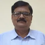 Akhouri
"
width="406"
height="371"
loading="lazy"
>
Academic Profile

Award and Honours

Project
Leadership & Institutional Service
Teaching & Mentorship
Award and Honours
Invited and participated in 30th Meeting of Jharkhand State Geological Programming Board (JSGPB)-cum-Technical Deliberation on Application of AI and ML in Geology & Mining, 9 September 2026, Radisson Blu Hotel, Ranchi.
Invited as a Resource Person and delivered a talk in a program on ‘National Space Day’ at the Geology Department, St. Xavier’s College (Autonomous College of Ranchi University), 22 August 2026, Fr. Proost Hall (SXC), Ranchi.
Invited to the Dryland Congress 2026 to participate as panellist in the side event titled Climate Smart & Value Chain Analytics for Resilient & Sustainable Agriculture being organised by ‘ICRISAT’ in collaboration with ‘LeadsConnect Services Pvt. Ltd.’ at
Current Sponsored Projects
- Geophysical characterization of subsurface Calcrete deposits in semi-arid-arid region of Rajasthan using fully polarimetric L- and S- band SAR data, L&S Band Airborne SAR Research AO; SAC/ISRO Ahmedabad, Rs. 13.44 L (2018-20) - V S Rathore, A P Krishna, G
- Land Use / Land Cover Analysis - 3rd Cycle, NRSC/DoS Hyderabad, Rs. 51.50 L (2016 - 19) - C Jeganathan, A P Krishna, V S Rathore, R N K Sharma, N K Sinha
- Hydro-geoinformatics for water resources assessment of Ranchi, Urban and Suburban areas, In - house Research, BIT Mesra, 2006, Institute incentive scheme (2006-08) - A K Singh, A K Sinha, B Singh, A P Krishna, R N K Sharma, R Shivkumar
- Environmental Impact Analysis of Natural Hazards in Sikkim, Himalaya, GBPIHED In house Research, 2004, Variable budget as per needs, 1 Year (with yearly extension provision) - A P Krishna
Intellectual Property Rights (IPR)
-
Indian Patent Application no. 202631100313 filed on 19 August 2026 Inventors: Banerjee, S., Mahto, S., Krishna, A.P., Roy Mukherjee, N., Anand, S., Rathore, V.S., Kumar, A. Title: ‘A method and system for water body morphometry’
- Date:
Fellowship
- Fellow Member, Geological Society of India [FGSInd] – 2004-2011